Commercis
Commercis
Commercis Group of Companies
Companies
Brands
Commercis Brands
Unlocking your power of connectivity with our satellite, fibre and hybrid communication solutions
Learn More
Providing you with scalable, secure and reliable hosting and data centre services
Learn More
Pioneering new technologies enabling you to stay ahead of the curve with cutting-edge solutions
Learn More
Emphasising innovation, collaboration, and responsible practices to deliver a holistic, adaptable, sustainable and resilient global infrastructure
Learn More
Using digital intelligence to harness the power of data and the latest technology for a secure digital transformation
Providing reliable, fast and robust communication and connectivity services
Visit site
A large teleport facilities, data center services and reliable infrastructure for data management
Visit site
Providing internet connectivity directly to end-user whenever its needed
Visit site

The use of satellite imagery in warfare

The use of satellite imagery has played a significant part in the events currently taking place in Ukraine. Military satellite imagery earlier this week has been able to showcase further destruction caused by Russian armaments.

On Monday 6 June, 2022, high-resolution satellite images captured building damage caused by shelling and military explosions in Severdonetsk in the Donbas’s Luhansk region – the largest city in Ukraine that is still under their control.
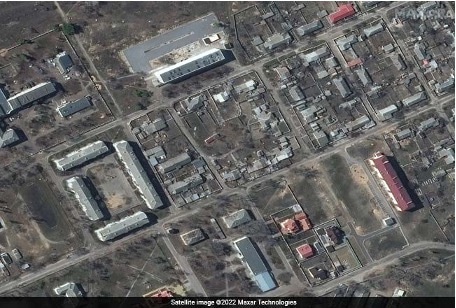
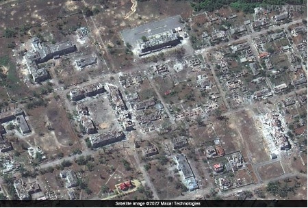
The images below demonstrate satellite pictures of the same area just 24 hours apart.

The images were able to identify the military destruction being caused by Multiple Rocket Launches – or MRLs – to execute these attacks as seen below.
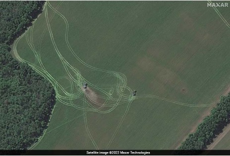
70% of Ukraine is under Russian control, however, Ukraine is still finding back and satellite images such as those shown in this news article play a major role in boosting the operational capabilities of the nation's armed forces.

Our brands
Sign up for the latest news
Subscribe
Follow us
chevron-down